Sunday, October 30, 2011

THE TRIP ENDS IN BAKERSFIELD

Kern River

DATE:  Sun, October 30
HOME: Bakersfield, ca  Sheraton
DISTANCE: 63
ALTITUDE: 2600
WEATHER: Perfect
NARRATIVE:
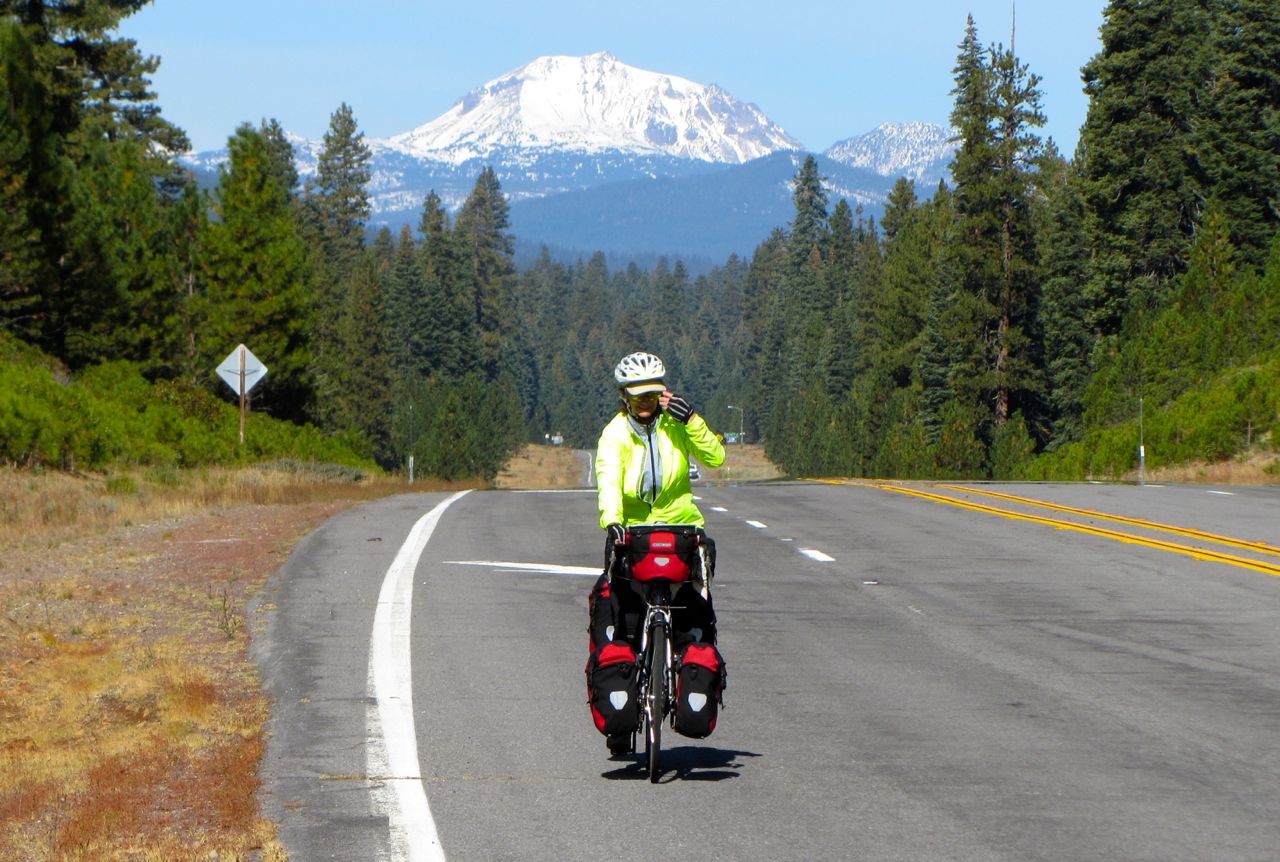
Our ride today -  our last for this trip – was supposed to be a mostly downhill 53 miles.  We did make it to Bakersfield, but it was 2600 feet of climbing and 63 miles!  That said, it was a fascinating ride through the mountains following the Kern River most of the way.  The Kern has created beautiful canyons as it plunges down the mountains.  For 40 miles we followed the Kern through these canyons till we emerged with a sign that said, “Bakersfield 17 miles.”  Here it opened up to flat, treeless vistas – except for the orange groves that have sprung up with water from the dammed up Kern River.  A most bizarre sight was climbing a bluff with acres and acres of irrigated orange groves breaking the brown of the hillside.  Then to look at the top of the bluff and see two housing developments.  We had just read in the paper last night that Bakersfield-Delano area was one of the top 10 for the number of underwater mortgages and unemployment in the US – and these recent developments were what were underwater.  Many looked unoccupied, and the development was in the middle of nowhere.

One thing Bakersfield has done right, though, is a bike/multi-use path along the Kern River through Bakersfield.  Along this path are multiple parks.  Makes for nice biking without having to go onto city streets.  We had a great taco dinner at Kay and Brian's - not only did they just get back from Milan at midnight last night, they are hosting two Korean visitors, and still found time to cook dinner for us all!

A few Final statistics – more to come in the following days:
Miles we rode on this trip:  2, 050
Climbing: 145,000 feet

Saturday, October 29, 2011

A DAY OF EXTREMES

On the climb up to Mountain Top Inn

DATE:  Sat, Oct. 29, 2011
HOME: Kernville, ca.  Whispering Pines Motel/B&B
DISTANCE:  55miles
ALTITUDE:
WEATHER: Perfect, but another day of extremes:  began at 42 degree, ended at high 70’s
NARRATIVE:
A great day of riding.  We began early – not only to outsmart the bugs, but we had a lot of climbing and many miles to go to get to Kernville.  At 42 degrees we had most of our layers on, but they were soon shed as our climb was 8-13% at the start, then settled in to a more gradual 8-10% grade.  Once the sun hit, the bugs began to gather.  Fortunately, we got to the 6,000foot level and, just like Sequoia NP, they pretty much disappeared.  We could then settle in and enjoy the ride through the vegetation zones as we topped out at 7200 feet.  The forest was beautiful, steep, and rugged.

At the top we had lunch at the Mountain Top Inn, which was cold when we went in, and hot when we began our descent.  Again, we went through all the vegetation zones, but a surprise was A Sequoia Grove, and a beautiful one at that, around 6,000ft.  Then, at around 4,000 ft. we suddenly hit desert again, but this was the harsh rugged desert.  Once we hit the Kern River the only green was the area immediately surrounding the banks of the river.

The desert near Kernville
At Kernville we found a really nice B&B/motel with rooms with a deck overlooking the river and the surrounding mountains.  In the late afternoon sun it was beautiful.  A great find for our last day on the road.  Tomorrow we ride in to Bakersfield and end our trip – for now. This section of mountains has been beautiful….the trip will be continued – in the Springtime when the desert is in bloom.

Friday, October 28, 2011

RESCUED BY CAL-FIRE

Kerk Swartclander and Phil Brown
CAL-FIRE, Tulare Unit

DATE:  Fri, Oct. 28, 2011
HOME: Pier Point Springs Resort near Camp Nelson, Ca
DISTANCE:  16 (Bob), 10 (Shelagh)
ALTITUDE: 3500 (Bob)  1500 (Shelagh)
WEATHER: Perfect, except for GNATS!!!!
NARRATIVE:
On the way to Pier Point Springs Resort.
The weather was perfect, the scenery spectacular (steep forested hillside with the Tule River below), and the road windy and steep (sometimes up to 13%, often 8-10%, but with a few flat spots to rest).  The climbing was actually doable (we’re strong and rested).  So what was the problem?  GNATS – they swarmed at the worst times, when you’re struggling up the 10-13% grade and having difficulty taking a hand off the handlebars to swat them.  They seem to know this and get up your nostrils and down your throat.  Bug spray completely ineffective; if there was ever a time we needed mosquito netting for our heads, this was it.  But, we had none.

I was on the side of the road with my head down trying to get rid of the bugs, lifted my head when I heard a truck coming round the corner, and seeing it was a pickup without a load, stuck out my thumb for a ride.  Turned out it was CAL-FIRE and they were more than happy to take me up to Pierpoint Springs (it’s where they were going for lunch and a meeting).  Bob, of course, declined.  Nice guys – we talked fire, and it turns out one of them was fighting the 1991 Oakland Hills Fire.  He was with the Fresno Fire Dept. at the time.

Meanwhile, Bob was freed from my slow pace and nasty mood, had a fun and fast paced ride up the rest of the hill to the resort.  I had showered, and was walking to the restaurant for lunch when he appeared, sweaty, with bugs swarming around him, but smiling.  He always likes those challenges – glad I could help him out:)

Thursday, October 27, 2011

NO SERVICES


While this sign was at the beginning of our road today, it's a good symbol for many of our roads.  No Services has doubled the time we usually take each evening in figuring out where to stay, and what we need to take with us for the day.  

THE LONELY ROAD


On the way to Springville

DATE:  Thurs, Oct. 27, 2011
HOME: Springville, ca  Springville Inn
DISTANCE: 35 miles
ALTITUDE:  2600 ft gained
WEATHER: perfect
NARRATIVE:
After a fabulous breakfast at our B&B we got on the road around 9:30.  What a beautiful ride it was today.  No more than a dozen cars and a handful of motorcycles did we see all day long, not a single store, and few houses – but lots of cattle – this is ranching country!  Wonderful, lonely roads to ride with with hills, oaks, grasses and large rock out croppings.  While this is desert country this time of year the sun is low, casting shadows on the hills, which soften them.  We had a nice lunch just before our big climb to the top of the mountain, which zigzagged up at a mostly 5-7% grade.  Only occasionally did it go higher.  Once up, it was a nice 10 mile downhill to Springville.

Springville Inn, Springville, CA
The Springville Inn:  Built in 1911 it’s the cornerstone of this town, which, at first glance, looks like a bustling town – nicely restored houses, new sidewalks, newly paved streets.  The first sign that anything was wrong was our Inn – big FOR SALE signs outside.  The owner is still keeping the motel open, but this was a destination hotel – nice banquet rooms, a high end restaurant with lots of outside seating.  And our room had recently been remodeled and was very nice.  The owner said the recession hit them big – they are this little out of the way town and people stopped coming.  We thought how sad it was – she had put her heart and soul into refurbishing the place (opened in 1998), and now she has to sell it, but no one is buying yet.
Then we took a walk along main street and found a good number of stores closed down.  One woman said that the valley had 25% unemployment with lots and lots of homes in foreclosure.

Wednesday, October 26, 2011

LEAVING THE SIERRAS


Sequoias at Giant Forest

HOME: Lemon Grove, Ca.  Plantation B&B
DISTANCE: 40 miles
ALTITUDE: Descended 7200 ft., ascended 1,000.  We’re 6200ft. lower than yesterday
WEATHER: Perfect
NARRATIVE:
Greening the desert thanks to Kaweah Dam.
Today we left the Sierras and the Sequoia groves for the desert and palm trees in one dramatic drop.  A fascinating descent where we began in the morning with the temperature at 38 degrees, and ending at our B&B with a temp of 72.  One amazing ride going through the vegetation zones of the big trees to the foothills of oak, Manzanita, maples, and buckeyes to the bare desert hills.  We had lunch in Three Rivers, a scenic town made up mostly of motels, and aptly named three rivers – the North Kaweah, Middle Kaweah, and South Kawea all merge here to form The Kaweah River, which is dammed just below Three Rivers and “greens” the desert.

Our B&B, in Lemon Grove (named in late 1800’s when they did grow lemons.  No one wanted lemons in LA, they liked oranges, so the owners ripped out the lemon trees and planted orange trees.  The name stuck).  The theme of the B%B is Gone with the Wind, we are in the Scarlet O’Hara Room, and the large back yard, with it’s palm trees and grass gives the feel of an Oasis in the desert. We spent the last few hours of daylight under the palm trees soaking up the sun. Our room looks to the surrounding hills, which are lovely in the late afternoon light.  The owners have been in business for 15 years, and it is a lovely place.

We encountered our first bicyclist in quite awhile today – a 22 year old German guy who was heading uphill to Sherman Tree in Sequoia.  The remarkable thing about his journey is that we met him at the bottom of our descent at around 2:00 and it is dark at 6:30, and he had no idea it was 6,500ft. of climbing and 38 miles to Sherman tree, and thought he could make it today. We told him the situation; there are few services beyond Three Rivers – he seemed undaunted – I guess it has something to do with being only 22:).

A NOTE ABOUT OUR CHANGE OF PLANS:  As it turns out we are both ending the trip in Bakersfield in 4 or 5 days.  The logistics of getting through the remote desert mountain areas below Kernville were getting difficult.  There’s lots of climbing and great distances between services, even camping, and the days are getting very short (dark by 6:30).  We’ll rent a car in Bakersfield, check out some of the areas on this last section to see if we want to do it another time.  My thought is that it would be beautiful in the Spring, combined with a trip through Anza Borrega and Joshua Tree.  There’s nothing more beautiful than the desert in the Spring.

THREE DAYS IN SEQUOIA NP


A walk up the creek - lovely


DATE:  Oct. 23-25
HOME: Sequoia NP
NARRATIVE: 
Three days in Sequoia, relaxing, viewing the Big Trees, hiking on the beautiful granite trails near Wuksachi Lodge – water cascading over the gradite – to us, the most beautiful sight.  Our regret – that we didn’t take more time to do the same in Yosemite.  Now that we have officially changed our plans enjoying the Sierras in the Fall, which we have never done before, just seemed like the right thing to do.  What a fabulous place! 


Monday, October 24, 2011

BIG CHANGE OF PLANS

Wuksachi Lodge
This AM we both still felt tired, and decided to stay here one more day.  The rest of the route has us leaving the Sierras - we were going to find a way to not ride a remote and not very interesting (to us) area.  Before breakfast we asked if our room was available for tonight; it was.  By the end of breakfast our "one more night's stay" had expanded to two.  The revised plan is to ride in to Bakersfield.  I will most likely call this the end to the trip, rent a car, take Bob back to the Sierra Cascades route, and drive home.  Bob will continue on to finish our route and reach our original goal.

What this means for this morning is contacting the places that we had already made reservations at and pushing them back two nights.  We hope this works.  

THE GENERAL'S HIGHWAY, SEQUOIA NP


DATE:  Sun, Oct. 23, 2011
HOME: Sequoia NP, Wuksachi Lodge
DISTANCE: 26 miles
ALTITUDE: 3,000ft
WEATHER: Perfect – mid 70’s
NARRATIVE:
Today was supposed to be a relaxed, easy ride with 500ft. of climbing along the general’s highway, stopping along the way to see the magnificent sequoias.  And it was,  except for the climbing.  3,000ft of climbing and 4 1/2 hours later we got to Wuksachi Lodge.  What a beautiful setting, nestled in the trees with the white Sierra granite peaks sparkling in the background.

How did 500ft turn into 3,00ft.? We’ve had trouble with mistakes on the Adventure Cycling maps all along on this Sierra Cascades Route, but this section in Sequoia Park had two maps exactly the same.  We checked the addendum for these two sections, and they had corrections, which still contained major mistakes.  The addendum had us climbing only 500ft, which turned into 3,000ft!

The ride today was beautiful meandering along a windy road that went down to creek crossings and then climbing up out of them.  The views of the high sierras were spectacular, and there is nothing more magnificent than the giant sequoias up close.

Sequoias:  Can be up to 300ft. tall and 40ft. in diameter. Unfortunately, loggers saw $$$$ and in the early 1900’s major groves were chopped down.  Luckily, conservation minded folks won the battle and Sequoia NP became the 2nd national park.  The rest of the twentieth century was fire suppression and the building of recreational facilities in the NP.  Today, all over, we are awakening to the need to truly preserve and save our national parks, and here in Sequoia/Kings Canyon that means preserving the remaining groves, and restoring many areas to its natural habitat.  The conservation or "green ethic" has been prevalent in all the wild lands we have visited all along our route - very encouraging.

We had heard on the news that several big trees had toppled over, which is about the only way sequoias die (there are a number over 2000 years old). When we asked about it, apparently they were in the wilderness somewhere and no one actually knew the location.


The Wukaschi Lodge is quite nice (as compared to the John Muir lodge in Grant Grove).  Good restaurant that looks out over the mountains, deer strolling by, generally nice.  In Grant Grove we had the parking lot outside the restaurant with RV’s rolling by….

Both of us are pretty tired tonight; the continued climbing every day is taking its toll. Tomorrow should be a lot of downhill (6000 feet) so we will see if that is an easier day and we recover.

GRANT GROVE, SEQUOIA NP


The beautiful Sequoia's in Grant Grove

DATE:  Sat, Oct. 22, 2011
HOME:  Kings Canyon, John Muir Lodge
DISTANCE: 0 Layover Day
WEATHER: Perfect
NARRATIVE:
Slept in, had coffee, listened to NPR, and then went to breakfast.  Bob spent the morning planning next week – and there is a section around L.A. (our route goes through the mountains and shoul be beautiful – map shows a California Scenic By-way) that we’re having trouble finding a place to stay – camping or hotel – within reasonable riding distances.  One piece that was critical, a lodge, was booked for all of October with a group!?)  Anyway, he’s working on his sister, Kay, picking us up in Kernville and taking us across the difficult section.  Haven’t heard from her yet, but, if she can’t do it, we’ll move to plan C, D?!  Been there before on this trip.

We have both decided this is probably our most difficult long distance trip ever.  We spend inordinate amounts of time trying to figure out where to stay each day.  We have to take into account, not just mileage, but climbing.  And, the distances between places can be enormous with no place to stay, not even camping.  Days that we thought would be relaxing and short, turn out to be almost a full day's ride.  Beautiful riding, but, especially here in the Sierras we really want to be on the hiking trails, not the roads. The number of days with less than 3,000ft. of climbing is just a handful.  While we’re feeling incredibly strong our whole bodies are needing a rest, so our time between layover days is getting shorter and shorter.

Back to our day:  We took a nice, leisurely walk in Grant Grove this afternoon to the Grant Tree.  These are absolutely magnificent trees.  The Jeffrey, Ponderosa, and Cedars are also wonderful. It felt good to be on a trail rather than the bike – and we realized how close we were to some of our favorite high Sierra sites, and that there’s a canyon here we haven’t explored.  In short, we found next year’s backpacking trip!

Friday, October 21, 2011

SEQUOIA NATIONAL PARK

Gena's Place - outside our cozy closet- sized room

DATE:  Fri, Oct. 21, 2011
HOME: Sequoia NP, John Muir Lodge
DISTANCE: 18 miles
ALTITUDE: 4600ft
WEATHER: Perfect, except for gnats
NARRATIVE:
It may not have been many miles, but it was A LOT of climbing.  Luckily, the entire route was a steady climb between 5-7%.  It still took us 4 ? hours with a delightful coffee break at Snowline Lodge.  The weather never got hot – but cooler as we ascended, and we finally hit trees at around 4500ft – and then at 6,000ft the cedars and sequoias began to appear and the bugs began to disappear!

The ride on 180 was mostly along a ridge that wound around and up, and the valley below is a thriving community of Dunlap and Miramonte, and Pinehurst (where the ACA route goes).  Beautiful valley of farms and ranches.

John Muir Lodge:  a new lodge in Grant’s Grove – but the architect came right out of the Motel 6 design school.  It’s a shame for a national park lodge – it lacks character, but is comfortable.

We both crashed for most of the afternoon.  It was a long ride today, and we are ready for our layover day tomorrow.  Once recovered we figured out the rest of the trip.  Looks like we won’t be home till Nov. 7 or 8. Depends on weather and how far we want to push each day - there's a lot more climbing in the SoCal mountains.

FOOTHILLS ABOVE FRESNO

Foothills above Fresno

DATE:  Thurs, Oct. 20, 2011
HOME: Gena’s Place, off 180 near Clingan’s Junction
DISTANCE: 54 miles
ALTITUDE: 3200 ft
WEATHER: Perfect in the AM, then HOT
NARRATIVE:
After a great breakfast at Auberry, we were on our way with another great descent.  Unfortunately, we were enjoying the descent so much we missed the turn-off to Pine Flat Lake.  I noticed the turn but Bob was already sailing downhill – it took me a couple of miles to catch him.  Turns out, it was no problem in that there was another way to go, which was shorter.  This one went further down towards Fresno on beautiful, empty rural roads.  While probably not quite as scenic as ACA’s route the ranches and farms in the area were quite prosperous.   We also found some local conservation action – one was savethefoothills.com – save the valley from a mega power station.  It’s a beautiful area and would be an absolute shame if a power plant were built there. The other was to save a canyon and mountain off 180 just outside of Fresno from Mining. The increase in traffic and pollution would again destroy an area.

Once we got onto 180 in the foothills above Fresno we had only 15 miles (most of our uphill), and it was HOT (85 degrees) with hardly a tree in site.  I bonked – and Bob saved me by becoming my SAG!  He took my front panniers and tied them to the top of his rear rack.  He was feeling great – even with the extra weight.  We did eventually make it to our destination, a cute restaurant with a small motel with closet-sized rooms.  But Gena, the young woman who owns and runs the place mostly by herself, has decorated the closet so that it’s homey and comfortable.  We had a great dinner .  It’s good that this all turned out OK since it’s the ONLY place to stay until we get to the park – 18 miles and 4200 ft.  Tomorrow’s ride!


Wednesday, October 19, 2011

DESCENDING TO THE SAN JOAQUIN RIVER

Change of scenery as we descend to the San Joaquin River.

DATE: Wed, Oct. 19, 2011
HOME: Auberry, Ca.  Joe’s Java Time/Baba-Lu’s Java time
DISTANCE: 42 miles
ALTITUDE: 2900 ft
WEATHER:  Perfect
NARRATIVE:
Because we didn’t have a long way to go today, we had a leisurely breakfast and didn’t start till 9:15.  We immediately dropped 2,000ft. to the turn-off to Bass Lake.  Good road, fun descent, and we could feel the temperatures warm up; by the time we got to Bass Lake an hour later it was warm and summy.

We took the Adventure Cycling route around the lake to North Fork rather than the Wawona Chef’s route – and we’re glad we did.  No traffic, and the road was right next to the lake.  All services were closed, but the campgrounds looked nice and would be great to stay in.

Once past North Fork we plunged down a 9% grade another 2,000 ft.  to the San Joaquin River, where we had lunch.  The temperature was in the high 70’s, and we’re truly in desert country now.  Classic foothill country.  Now our climb begins – 8 miles and 1500 ft. up to Auberry, our home for the evening.

Auberry:  a fascinating little place. We were pleasantly surprised. Above the Java Place was a very well maintained small motel.  Joe’s (the owner) son-in-law runs the Java Place.  It turns out that Joe not only has the motel but several houses in Aubrey that he rents out.  The room that we were to have in the motel had only one queen bed.  While that is sufficient for most couples, Bob is 6’3” and the two of us don’t fit well on a queen.  Joe had the solution – a 3 bedroom house was empty.  We have LOTS of room tonight.

The town has been hit hard by the recession.  Joe had a thriving business, employed 30 people, decided it was too much, and bought the Java place.  It has done well, and his son is running the coffee shop.  But, the elementary school (which looked really nice and updated) was closed last year.  This reduced traffic in the town, and his son is shutting down the café and has found another job.  Joe is back in business and wants to keep it open.  Joe’s story, and the story of the town with many shuttered stores and houses for sale is the sad story of the recession in many places.

We had dinner at the only restaurant in town, a Mexican restaurant.  It was fun and funky where the whole community comes in to chat and have dinner.  While Auberry is having a tough time it’s close to Fresno, and the surrounding area does not look really poor, like the area around Mt. Lassen.

Good weather, warm temperatures, fabulous scenery, good roads, no wind - is there a downside?  Yes - GNATS.  We thought all the bugs froze during the last big storm, but they have now gotten a new lease on life - and attack us at our most vulnerable time - when we're climbing up hill.  In North Fork we bought some bug spray, which helped a little, but they do seem determined.  In North Fork people were telling us the gnats have been bad all year.  We did have a slight breeze on today's ride, so we had a reprieve from the gnats.  

Tuesday, October 18, 2011

LEAVING YOSEMITE

Classic View - on the way to Wawona


DATE:  Tues, Oct. 18, 2011
HOME: Fish Camp, Tenaya Lodge
DISTANCE: 36 miles
ALTITUDE: 4,000ft
WEATHER:  Perfect
NARRATIVE:
We hated to leave the comfort and luxury of The Ahwahnee, but move on we did – to Tenaya Lodge just outside of Yosemite.  We wanted to stay at Wawona, one of my favorite places in Yosemite, but they were full.  So we opted for lunch instead.  And, much to our surprise, a big sign saying “vacancy” greeted us at the entrance.  We were told that guests left early today.  Oh, well, our hotel tonight is comfortable – just characterless.

The ride up to Wawona was fun and beautiful.  The climb never got over 8%, most was 5,6% - and our legs are now strong enough that we can climb these grades for quite a distance.  After climbing 2,000ft we had a fun downhill to Wawona, but the last climb  after a long, relaxing lunch was not easy.

The chef at Wawona is a bicyclist and came out to talk to us – gave us some advice on our route for the next couple of days, especially through Bass Lake.  He didn’t like the Adventure Cycling Route and said the other side of the Lake was a better road. We've found many mistakes on these maps so we'll probably heed his advice.

Another great day of cycling!

Monday, October 17, 2011

REST DAY IN YOSEMITE

View from patio at the Ahwahnee Hotel
View of Yosemite Falls from our window.
DATE:  Mon, Oct. 17, 2011
HOME: Yosemite Valley, Ahwahnee
DISTANCE: 0  Layover Day
NARRATIVE: 
Sweet was not having to get up early.  Sweet was having coffee in bed while listening to NPR this morning while enjoying our view of Yosemite Falls.  Sweet was having a leisurely breakfast with REAL orange juice.  Sweet was sitting outside on the patio this AM planning next week with a view of Yosemite Falls and warm, sunny weather.  Sweet was not getting on the bike today and using our feet to get around the valley.  Sweet was the view of half-dome on our walk.  Nice was actually being able to walk the valley without wall to wall tourists.

FABULOUS WAS THIS LAYOVER DAY !!!!!

HEAVEN

Sunrise in Lee Vining
Tenaya Lake
DATE:  Sun, Oct. 17, 2011
HOME: Yosemite Valley, Ahwahnee Hotel
DISTANCE: 66 miles
ALTITUDE: 3,030
WEATHER: PERFECT
NARRATIVE: 
Today was spectacular, from the beautiful sunrise that greeted us in Lee Vining, to the stunning scenery all along Tioga Road, to our final destination in Yosemite Valley, The Ahwahnee Hotel.  Today’s ride will forever be in our memories as our most spectacular day of riding – ever!  Then to end the day with our best dinner yet and a room with a view of Yosemite Falls – HEAVENLY!!

We began our ride at Tioga Pass Resort (TPR), which looked a little sad to us all boarded up.  During the 80’s and 90’s the wonderful owners opened it to Winter skiing.  Every year on our annual Holiday visit to SoCal we would spend a few days skiing up Tioga Pass Road and stay at TPR.  The owners transformed the place from its summer tourist center to a ski Chalet by literally moving all the furniture to the valley and replacing it with its winter décor.  Then, they retired and sold it to a SoCal enterprise that kept it operating in the winter for a few years, but they ultimately failed, in part because they wanted to turn it into an extreme skiing and snowboarding mecca.  They also had no clue as to how to make guests comfortable and welcome.  Enough on TPR

We biked from TPR to the Yosemite entrance, passing Mt. Dana (which our dog, Dana, is named after).  Then it was on to Tuolomne Meadows, Tenaya Lake, Olmstead Point, views down the valley to Half Dome, Clouds Rest above us.  While we ultimately dropped 6,000ft to the Valley, our total drop was 9,000ft.  It was a day of long rollers that culminated with a steep and beautiful drop into the valley on Hwy 120 (a road I would NOT want to be on with lots of traffic).  With the valley below us and the valley walls as our backdrop it was a fabulous downhill. 

Tomorrow is a lay-over day; we look forward to a restful day in the valley as we plan our next week’s biking, which will take us to Sequoia National Park. 

Saturday, October 15, 2011

FALL COLORS

On the way to Lee Vining from Bridgeport
Mono Lake and the High Sierras
DATE:  Sat, Oct. 15, 2011
HOME: Lee Vining, Ca   Lake View Lodge
DISTANCE: 25 miles
ALTITUDE: 2000 ft
WEATHER: Perfect
NARRATIVE: 
What a difference a day – or rather, a good rest – makes!  The fact that our ride is only 25 miles to Lee Vining so we can take our time and enjoy the views, which were SPECTACULAR! 

Fall in the Sierras – a spectacular scene of colors from the Aspens – and something we had never really considered.  But, the display of colors with the snow capped Sierras in the background was simply gorgeous.  At the top of Conway Summit we have displayed before us the High Sierras, and around a corner Mono Lake and the descent to Lee Vining. 

This has to be our best ride yet. 

We are both feeling good about the next few days, also.  Everything at Tuolomne Meadows is closed, we heard nothing from my favorite resort (Tioga Pass Resort) so we assume they are also closed, and it’s dropping below freezing so we don’t want to camp.  We considered going the whole distance in one day to the Valley, but that’s 82 miles so decided against it.  Our plan D, or was it E was to get a taxi to Ellery Lake then ride the rest.  That’s our plan tomorrow, then two nights at the Ahwahnee.  We are really looking forward to this “vacation within a vacation” in Yosemite.

Now it’s to dinner at the only restaurant in Lee Vining – Nicely’s.  We have a fondness for Nicely’s, not because of good food, but because we have been there so many times over the past 35 years. 


Friday, October 14, 2011

MONITOR PASS

Views as we ascend Monitor Pass
Descending Monitor Pass
DATE:  Fri, Oct. 14, 2011
HOME: Bridgeport, Ca.  Ruby Inn
DISTANCE: 63 miles
ALTITUDE:  6,030
WEATHER: Perfect, except for headwin along 395
NARRATIVE: 
We started early today because we had a long way to go – to Bridgeport, which meant lots and lots of climbing as well.  We began by conquering Monitor Pass (which we’ve done the other way).  It took us 3 hours because the grade was mostly 10-12% with a few 13s as well as 8s to let us catch our breath occasionally.  The views of the mountains and the Fall leaf display from the Aspens made for a great, but challenging ride.  We flew down to 395 – again, the view of the valley below was spectacular.  Found a new Restaurant/motel just before Walker (our lunch destination).  If we had stopped there, kicked back for the afternoon, all would have been well.  And, that was our plan till we realized we needed to get to Yosemite on Sunday, so needed a long day to set ourselves up to go over Tioga Pass. 

But no, we were heading 30 miles and 2400 more feet to Bridgeport.  It’s a beautiful ride up a canyon – 20 miles of it is uphill.  While only a 2-3% grade for 20 of those 30 miles, a moderate headwind made it like a 5% grade.  It kept going and going and going.  It took us 3 hours to do the 20 miles.  Tired at lunch, now exhausted, we did have a fast and fun downhill the remaining 10 miles to Bridgeport.  Ruby Inn – standard, but comfortable motel.  Good dinner at the Bridgeport Inn.

Ten hours on the road today – too long.  Our bodies need a lot of mending overnight.

Thursday, October 13, 2011

GLORIOUS

Lake Tahoe, Emerald Bay
DATE:  Thurs, Oct. 13, 2011
HOME: Markleeville, Ca.   Creekside Lodge
DISTANCE: 46 miles
ALTITUDE: 3500 ft
WEATHER: Wonderful.  36 degrees @ start, high 70’s by afternoon.

NARRATIVE: 
There aren’t enough superlatives to describe today’s ride.  We left Meeks’s Bay riding towards South Lake Tahoe, but rode around Meeks’s Bay and Emerald Bay.  Stunningly beautiful – the early morning light with the classic Sierra mountaintops as the backdrop – what can I say – we love the Sierras, and they were at their best today.  We both easily put Emerald Bay as our most spectacular place on our ride.  Little traffic and few tourists also helped:)

Even South Lake Tahoe, an area I usually disdain, is cleaning up its act.  Of course, Bob’s mission was to get some new trousers.  Right at the intersection of 50 and 89 was an Outdoor Clothes Outlet.  Perfect, except that anything with a pants leg length of 34 comes with waist sizes of 38+, but he did find one pair of pants that fit his lanky body fine.  Then it was across the street to Starbucks for a caffeine fix so we could tackle 89 once again.

Much to our surprise, there is now a bicycle trail that begins right at the corner and went all the way to where 50/89 split.  We went on 89 up Luther Pass.  Most of the traffic left us, but we actually got to climb Luther Pass and descend it ALL ON OUR OWN WITH NO TRAFFIC!!
They’re doing construction and ferrying the cars up in stages to the top.  They let us go ahead, and said for us to stop only when they came with a group of cars.  Since we were going uphill these breaks were let us catch our breath.  The rest of the time we rolled up the hill in the middle of the road on wonderful pavement.  They’re doing a wonderful job on repaving the road, complete with an ADEQUATE SHOULDER and cubs.  We even saw spots where they’re finishing up with native plant landscaping!  The really fun part, though, was the ride down – without having to worry about other cars, we sailed down in the middle of the lane – right into lunch at Sorensen’s, my favorite Sierra Resort, where it was warm enough sit on the deck.
Our good fortune didn’t end there.  Our hotel in Markleeville, Creekside Lodge, is wonderful little motel with a good restaurant.  Only downside is there is no cell phone service or internet, but we signed up for a day with the Markleeville internet service.

The weather is supposed to keep warming up over the next few days so we should be in for some good riding weather – since we head over Tioga Pass on Sunday this is really good news.


LOST TROUSERS

View from our deck - Meeks Bay, Lake Tahoe
DATE: Wed, Oct. 12, 2011
HOME: Meeks Bay, Tahoe, Ca
DISTANCE: 49 miles
ALTITUDE: 3700 ft
WEATHER: Extremes again 32 at start – high 60’s at Tahoe
NARRATIVE: 
When we left Sierraville at 8:30 it was 32 degrees out.  An hour later it was already 47 degrees and climbing.  Destined to be another beautiful day in the Sierras.  The ride into Truckee from Sierraville is beautiful, with vistas of the meadows and forests all along the route.  Unfortunately, the traffic was quite bad, with full logging trucks dominating.  We were helped by the construction which stopped the traffic.  We were usually let through.  Rather than continuous traffic we had the groups as the workers let them through the construction zone.  We pulled over when needed, but then had the road to ourselves until the next group came whizzing by. 

It took us until Noon to get to Truckee – lots of climbing, but fun climbing – many rollers, not one long steep climb.  Another transition was made in Truckee – a real population center, largest we’ve seen since we began riding in Bellingham. 

The ride from Truckee to Tahoe until we got to the bike trail at Squaw Valley was really, really bad, but we had a wide shoulder.  Unfortunately, the pavement on the shoulder was in a state of deterioration, rivaling some of our worst Bay Area roads.  Once we got on the trail it was lovely – Tahoe is trying to preserve a little bit of nature in an area that is being overwhelmed with development.  The lake is truly a gem. 

The real story of the day, though, is Bob lost his pants.  He thinks he left them at Sierraville.  This wouldn’t be such a terrible loss for most people, but he travels with only ONE pair of pants for off-bike wear.  He did have a pair of shorts, though.  Looks like we’ll have to take a detour into South Lake Tahoe tomorrow morning.

It’s popcorn time as we watch THE WIRE.  We heard today that Police Chief Anthony Batts resigned, and once again, The Wire, while portraying gang life in Baltimore, has so many similarities to Oakland - politics, schools, crime, BUREACRACY!  It's a fabulous series by David Simon available on Netflix.  A must see.

SIERRAVILLE

Coming into Sierraville
DATE: Tuesday, Oct. 11, 2011
HOME: Sierraville, CA  Canyon Ranch Resort
DISTANCE: 45 miles
ALTITUDE: 3040 ft
WEATHER: Perfect. 
NARRATIVE: 
From the time we woke up we knew it was going to be a good day.  50 degrees and blue sky when we began riding; first time in a couple of weeks we’ve started riding without all our warm clothes on.  It felt strange at first, and we weren’t sure we could trust this new glorious weather, but we were certainly going to enjoy it while we could.  Good road, not bad traffic (even tho we were on 89), long but not steep climbs, and fun downhills made for a glorious day of riding.  We also made the transition to the Sierras – the predominant trees were Jeffrey, Ponderosa, and Juniper with a Manzanita understory.  Views opened up with the classic big meadows of the Sierras.  And, we had our longest flat ride of the entire trip – 7 miles into Sierraville.

Today was also another day of extremes. Calling our home for the night a Resort takes a stretch of the imagination.  The inside is actually fairly comfortable with two beds, a kitchenette, and a private bathroom.  It was probably a fairly nice place in the 60’s, but the outside needs a little TLC.  There’s a picnic table outside with a barbecue grill, and a nice stream nearby.  Problem is that they haven’t even bothered to take a weed eater to the grass so it’s hard to get to the picnic table.  With just a little TLC this could be a charming place.  Once again – no cell phone, no internet – and we’re only 30 miles from Truckee.


We had lunch at a cute little town, Graeagle, and passed several housing developments trying to attract upscale residents with the lure of golf – those trying to get away from overcrowded conditions of Lake Tahoe. 


Monday, October 10, 2011

RAIN DAY IN QUINCY

Lassen - the #1 highlight of the trip so far.
DATE:  Mon, Oct. 10, 2011
HOME:  Quincy, CA.  Featherbed Inn
DISTANCE:  Rainy day layover
WEATHER: RAIN, but warm
NARRATIVE: 
Neither one of us felt like biking this AM.  The alarm went off, we delayed getting up, thought maybe Graeagle only 30 miles away would be a good place for tonight, then do the bigger miles to Truckee.  We were still debating this as we went to breakfast (not fully packed like usual) when we felt mist.  Must be fog.  It was not supposed to rain.  B&B owner conferred that the forecast said no rain, but that’s not fog.  OK, Graeagle it is.  Then the mist turned to actual rain.  Our decision was made.  Stay here in comfort for another day.

We had a very relaxing day planning our next week.  We are no longer going to Truckee – tomorrow, Sierraville; Wed, Meeks Bay (which we really like; we stayed there at the start of a month backpacking trip a few years ago); Markleeville, Walker, Lee Vining, then up over Tioga to the Valley.  Unfortunately, that put us in the Valley on Sat. night with nowhere to stay – everything was all filled up.  On to plan B, which has us camping somewhere on the way down to the valley and then staying Sunday in the Valley (openings).  Weather is supposed to be good, but then it wasn’t supposed to rain here today, either.  Hopefully, we don’t have to go to plan C.

We had a fun dinner at a place called Pangea – Mexican food with a blue-grass band:) 

LUXURY IN QUINCY

Cabin at Child's Meadow
DATE:  Sun, Oct. 9, 2011
HOME: Quincy, Ca  Featherbed Inn
DISTANCE: 62 miles
ALTITUDE: 2,000
WEATHER: 32 degrees this AM, ended in Quincy in the 70’s.  Beautiful Day
NARRATIVE:   A day of extremes.  At child’s Meadow this morning, when we began biking at 8:30 it was 32 degrees and we were heading downhill!  We had all our warmth on, were warm biking.  Around 9:30 it began to warm up.  After lunch we were stripped of all layers except our pants and jerseys!  What a treat – it’s been at least two weeks – or since we left Crater Lake that it’s been so warm.
The biking – even though it was on 89 the traffic was light since it was Sunday.  From Child’s Meadow to Greenville, where we had lunch was some of the poorest area we had seen yet.  No towns to speak of (we didn’t go in to Chester), the houses and motels were all in a state of disrepair with “rusting tin and old tossed out treasure” landscaping in most yards.  Very sad and depressing. Especially since it is such a beautiful forest we were riding through.  The whole area from near Mt. Shasta to Greenville was quite poor and obviously hit by this recession.  We saw few young people, and the older folks we spoke to all seemed to have an understanding of events and geography surrounding them of about 10 miles. 

At Greenville we were hoping for at least a café open.  We were very pleasantly surprised as we turned a corner and entered town to see a bustling, restored town.  We had a pleasant lunch at Anna’s, our cell phones worked for the first time since leaving Mt. Shasta, so we called ahead to Quincy to reserve a room at a B&B that seemed nice.  Things were definitely looking up.  As I was leaving the cafe several people asked if we had been on "the ride" from there yesterday.  Apparently there had been a century ride around Lake Almanor. 

Transition: The ride from Greenville to Quincy was beautiful – 20 miles – 10 down and 10 up.  The topography was changing from the volcanic to the Sierra granite, we were heading down a beautiful canyon, then up along the feather river.  A big change – especially when we stopped to take our arm warmers off! 

Quincy – is a cute town.  Our B&B, the Featherbed Inn is really nice in an old Victorian one block off 89 in downtown.  We’re actually in a cottage next door – spacious, a real bed, a porch, a bathroom with a great shower.  We began to feel civilized again – and then, dinner, at Moon’s was wonderful. 

We’re slowly catching up on email, the blog, and searching for places to stay – and I appreciate the many comments and emails wondering if we're OK since we haven't posted for almost a week.  YES, we're fine, and still enjoying the adventure.  The day after tomorrow we will be in Truckee and take a layover day.  But for now, it’s to bed and a good night’s sleep.


MEMORY LANE - LASSEN NATIONAL PARK

Lake Helen, Lassen National Park
DATE:  Sat, Oct. 8, 2011
HOME:  Child’s Meadow Resort, just outside of South side of Lassen
DISTANCE: 35 miles
ALTITUDE: 3700 ft
WEATHER:  COLD (37), went up to 62, sunny not a cloud in the sky.  BEAUTIFUL
OUR HEALTH: Bob, sore throat; me felt sick going up but was OK later (smoke from controlled burn, couldn’t regulate our temperature, altitude, all had affect). 
NARRATIVE: 
We finally conquered LASSEN.  We woke up this AM, temperature was 28 degrees at 7:00AM, and it did not change till 8:00,, when it finally went up to 29.  Finally, around 8:30 it began moving upward more rapidly, and by the time we left at 9:30 it was all the way up to 37.  Chilly, chilly, chilly, but not a cloud in the sky.  As we climbed up to Lassen – 3500 ft. of climbing – the temperatures got higher and higher, and the views got better and better, there was no wind and not a cloud in the sky.  A perfect day!

In addition, this past storm that had us sheltered at Shasta for 3 days deposited 18 inches of snow and closed the road across Lassen.  It only opened yesterday.  Lassen is at its most beautiful with snow – I don’t find volcanic peaks really beautiful, but the dark volcanic earth covered with snow is a most beautiful site.  When we got to the top several kids kids were sledding down the slope.  We found a place in the sun for lunch and then began our descent.

Our descent was a trip down Memory Lane.   We used to come to Lassen cross country skiing and snow camping near Helen Lake in the late 70’s, early 80’s.  There was a ski resort at the southern entrance (closed in 1985), which is now the site of a really nice visitor’s center.  Helen Lake was glistening in the sun.  Lassen is a beautiful and spectacular park, and like Crater Lake, we saw it in absolutely perfect weather.  Luck was with us.

We were hoping to make it to Chester tonight, but only got as far as Child’s Meadow Resort.  It was a kinda funky place back in the 70's  but even more so now.  The resort burned down in the 80’s, they moved the motel part to another section, put RV hook-ups on the cement where the motel used to be, moved the store/restaurant, and have recently put in some cabins.  We wound up in a cabin, which is new and nice inside. But it, and several other cabins, are sitting atop cinder blocks.  The sad part is that Child's Meadow is a fabulous area with a gorgeous view of the mountains, but is a classic example of the “Landscape with all our past treasures” scattered all helter/skelter.  We were reminded that the reason we stopped coming to Lassen was because there were no good places to stay nearby.

The restaurant was open for dinner – there was one other group + us – and the food was surprisingly good (chef is from Mexico, speaks not a word of English). 

In the end we are amazed at how things have not changed in  and around Lassen – on either side.  Hat Creek is isolated and in their own world - a bygone era.   It’s been 3 days, since leaving Shasta,  3 days since we’ve had internet or cell phone, and 3 days since we’ve found regular lodging.  A true adventure, which could have been cold and uncomfortable had we been camping in our tent,  but has always turned out OK - and always fascinating. 

MANZANITA LAKE, LASSEN

DATE:  Friday, Oct. 7 2011
HOME: Lake Manzanita, Lassen National Park, Cabins
DISTANCE: 42 miles
ALTITUDE: 3200
WEATHER:  COLD, then warmer (60s), sunny - nice day
TRAFFIC:  Horrible
NARRATIVE: 
Today’s ride was all on 89, most with little or no shoulder – with lots and lots of traffic – 80% of the traffic was big trucks or RVs towing a car.  We must have pulled over a dozen times or more.  What should have been a fun ride was a difficult, stressful one.  We got used to the traffic, could always hear the trucks, and Bob, who was behind me, would say whether to pull over or not, but it is definitely not pleasant.

We had a fairly normal day of riding in that we found a café that was open after a couple of hours of riding in Hat Creek, then found another one 12 miles from Lassen (Old Station) for a late lunch.  At all of these places the people seemed to be what we have come to call “unencumbered by facts” and really didn’t even know what was 10 miles away.  Still baffles us, even though we’ve been encountering it since the beginning in the rural areas.

Our luck was with us today – we thought we would have to camp at Manzanita, and were trying to figure out how to stay warm in our tent.  We get to the tent site and find there are cabins!!  Brand new, just like Burney Falls State Park.  However, these were all full – except for the bunk cabin.  We have 8 bunk beds on either side of the room with a walkway down the middle.  Works for us – and we had a warm shower, a Laundromat, a fire ring, and a picnic table.  AND a warm place to sleep!  The definition of luxury has changed. 

Tomorrow is supposed to be even warmer than today, but getting up will be difficult.  As we are going to bed it is 36 degrees outside! 

BURNEY FALLS STATE PARK

The Falls at Burney Falls State Park -
DATE:  Thursday, October 6, 2011
HOME:  Burney State Park   Cabins
DISTANCE:  54
ALTITUDE:  3100
WEATHER:  Cold, damp, but not raining or windy
NARRATIVE: 
When we left Shasta this AM it was 37 degrees, and mostly cloudy.  The sun was trying to peak through the clouds, and we saw higher up on Shasta – the snow came very low last night.  Right away there was a 1,000ft climb (which warmed us up), and then a big drop into McCloud, where we were so happy to find a very nice café and had tea, coffee, and muffins.  We then had rollers trending upward to a pass at Bartle (19 miles) where we had lunch and tried to warm up.

Both of us were quite cold after Bartle, even though the temperatures were somewhat warmer – 47 by this time.  I called the cabins at Burney State Falls Park, and they had a two room cabin – no running water, or electricity, but a propane heater.  We said “fine” as it saved us some mileage going to Burney.  We get there at 4:00 (they stayed open late for us), but were a little surprised/shocked when they showed us, what appeared to be new cabins with bunkbeds and mattresses, a propane heater on the wall – and NOTHING else.  We were literally camping without the tent.

After adjusting and a hot shower which warmed us up, we got our camping stove out and had dinner outside.  I’m now “in bed” writing this – it’s getting dark at 7:30.  Luckily Bob charged everything last night so we can watch a WIRE or two.  At least it will be warm sleeping, and things are very clean and new.  So what’s to complain about?  We’re warm and dry.  Tomorrow will be the tough night.  We will really be camping at the Lassen Entrance Station.  They have no cabins.  Bob checked the weather at Lassen – tonight is expected to be close to a record low, and while its supposed to warm up tomorrow I think we will be wearing every bit of clothing we have to supplement our summer sleeping bags!


Monday, October 3, 2011

CHALET BOUND IN MT. SHASTA

Chalet at Mt. Shasta 
Short entry - The storm caught up with us this AM.  So, we spent the morning finding a place to stay in Mt. Shasta.  Our lovely B&B from last night is filled up.  But, we found a beautiful Chalet in the manzanita and pine forest (at a golf resort, but we can't see it) with a great view of a small lake.  It's been a wonderful afternoon lying around, listening to music and catching up on email, etc.  How we'll feel after 3 days of being Chalet bound I'm not sure, but right now it sure beats two days of riding in the rain like in Washington. 

Sunday, October 2, 2011

MT. SHASTA CITY

Mt. Shasta always in view today.

DATE:  Sun, Oct. 2, 2011
HOME: Mt. Shasta, CA, . Shasta  Mountain Inn
DISTANCE:  41
ALTITUDE: 2100 ft
WEATHER:  Cool, partly cloudy, but very stiff headwinds
NARRATIVE: 
Our goal today was to get to Mt. Shasta.  The weather report had winds picking up in the afternoon, getting colder, but no rain today.  We know we’ll be in Shasta for awhile if the weather report is right – there’s a front with high winds on Sun. night, Mon. morning, but the big storm is on Tuesday/Wed.  Our problem is that we need a clear day to go 60 miles to the next spot unless we camp, which also means we need a good day. 

I got an OMIGOD – the winds (yesterday)- email from Alison.  They actually persevered through extremely high winds to get to McCloud yesterday.  Turns out that Weed and the Shasta Valley are infamous for their high winds (a local told us 50-60 in the winter is not uncommon).  We had beautiful riding in the morning past open ranch land with views of Shasta dominating the skyline.  But, around 10:30 we began encountering stiff headwinds – our biking speed went front 12-14mph to 5-7mph.  We found some trees for a break, and about 10 miles from Shasta we began climbing and were somewhat shielded by trees from the wind. 

We actually had a difficult time finding a place to stay – we wanted a nice B&B intown within walking distance to stores/restaurants.  Finally settled on a wonderful place that had a spot for us tonight but not tomorrow, and then the following two nights.  Our thinking now is to go to McCloud tomorrow if this place has no cancellations – while only 10 miles away it puts us 10 miles closer (50 mile day) to somewhere to stay. 

Several people recommended a Japanese Restaurant, Vivifly.  Not good, and we remember how wonderful the one in Bend was….

Even though we may have to move on tomorrow we are soooooo looking forward to sleeping in tomorrow.  Breakfast here isn’t till 9:00 – very, very civilized.  And, they’re letting us use their washer/dryer to do our laundry:)  And they have a great view of Mt. Shasta.  Great place.  We can only hope there's a cancellation tomorrow since it will be raining all week!